A blue sky over your driveway says nothing about the air at the trailhead. Oregon can post clean readings along the coast while smoke settles into a valley farther inland, and you won't see that difference until you look it up or start breathing it.
Don't take the air at your destination for granted! The Oregon smoke map is free, it updates through the day, and once you know how to read it, a check takes about five minutes.
TL;DR Quick Answers
smoke map oregon
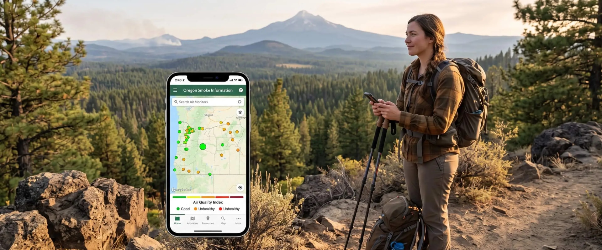
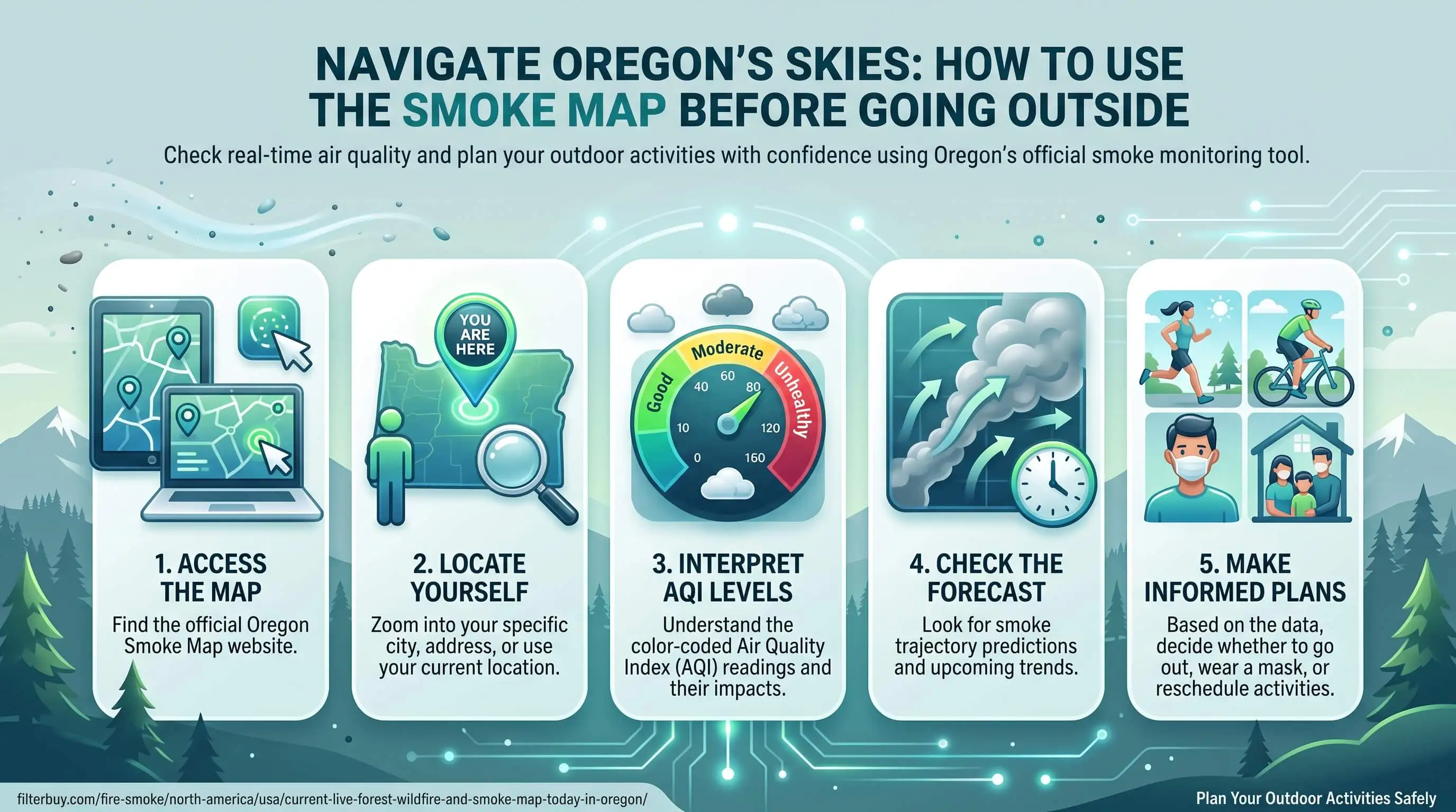
The most useful smoke map for Oregon is the AirNow Fire and Smoke Map, which Oregon DEQ also embeds on its Oregon Smoke Information blog. Search your destination, not your home, and tap the nearest monitor. The icon color shows the AQI category, while the popup number is a PM2.5 concentration.
Trust the ground: Satellite plumes can sit thousands of feet overhead, so let nearby monitors make the call.
Watch the trend: The dashboard's NowCast trend shows where air quality is headed over the next few hours.
Use OHA's June 2026 thresholds: Above AQI 150, cancel outdoor activities for kids or move them somewhere with cleaner air.
Recheck late morning: Valley inversions can trap smoke early and clear it by afternoon.
Get alerts: The free OregonAIR app pushes DEQ readings straight to your phone.
Top Takeaways
Check where you're going. Destination air matters more than home air.
Read the color, not the number. Popup values are PM2.5 concentrations, and the icon color is the AQI.
Trust the ground. Monitors outrank plumes that may never reach the surface.
Follow OHA's June 2026 thresholds. Above 150, cancel or relocate outdoor activity for kids.
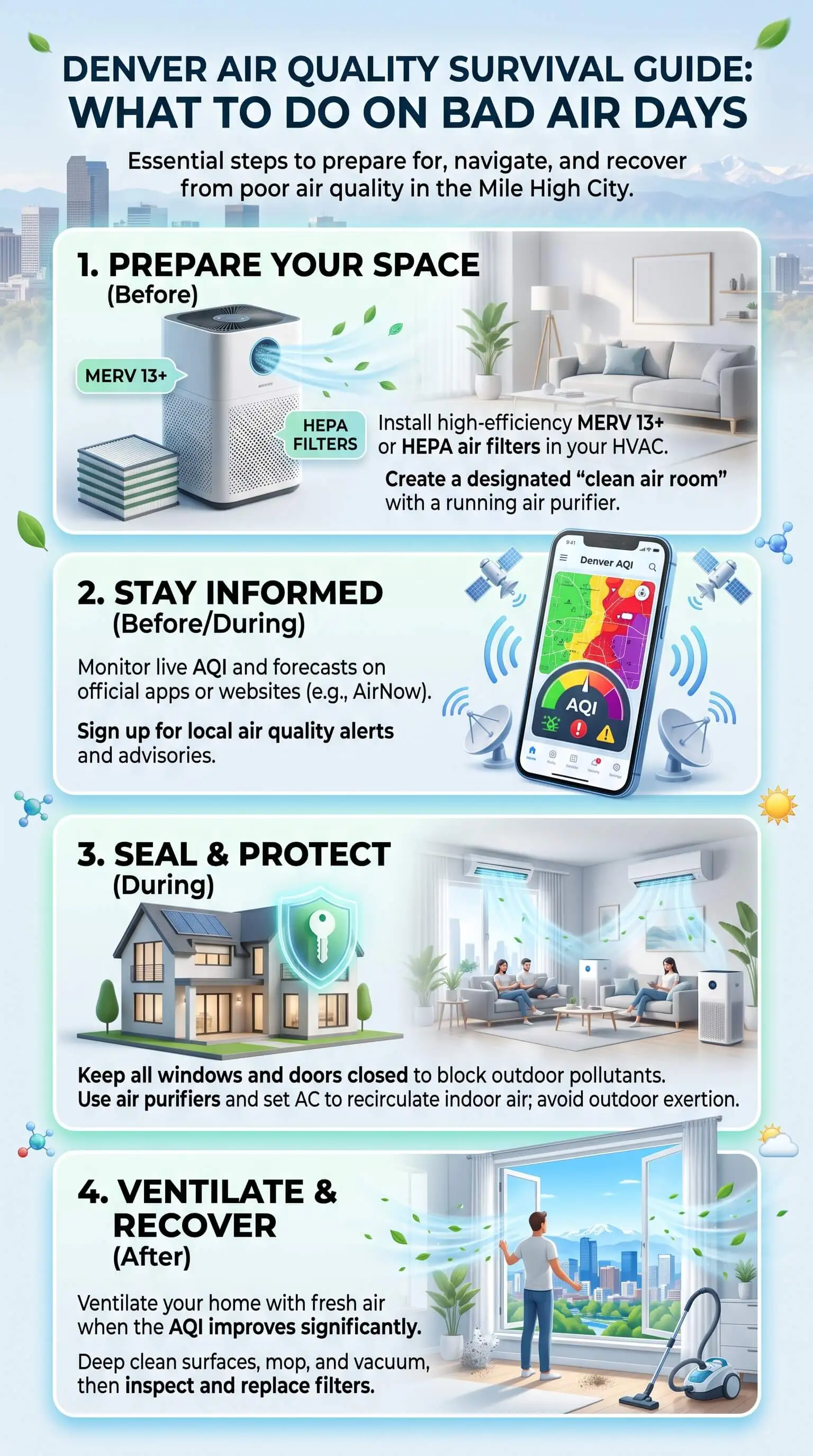
Close the loop at home. Recirculate, run MERV 13, and seal the duct leaks you can reach.
Which Oregon Smoke Map Should You Check First?
Open the AirNow Fire and Smoke Map first. It stacks permanent monitors, temporary smoke monitors, corrected low-cost sensors, active fires, and satellite smoke plumes onto one screen, which makes it the best single view of the air at a specific spot.
When fires are burning, make Oregon DEQ's Oregon Smoke Information blog your second stop. DEQ embeds the same map there and posts county advisories as conditions change. For alerts on your phone, the free OregonAIR app pushes DEQ readings straight to you, helping you know when high-efficiency filters may be needed to keep indoor air cleaner.
Step by Step: Reading the Map Before You Leave
Set your destination, not your home. Search the trailhead, campground, or field. Bend and Portland can read nothing alike on the same afternoon.
Learn the icon shapes. Round icons mark permanent monitors, and triangles mark temporary monitors that agencies set up near fires. Sensor icons come from low-cost sensors, and EPA and the Forest Service correct that data before it reaches the map. When a sensor and a nearby monitor disagree, trust the monitor.
Don't read the popup number as the AQI. Tap an icon and you'll see a PM2.5 concentration. The color tells you the AQI category, and mixing the two up is the easiest mistake to make on the whole map.
Watch the trend. The dashboard shows where the NowCast AQI category is headed over the next few hours if recent conditions hold. If it's climbing at 7 a.m., shorten the plan.
Let ground monitors outvote the plumes. Satellite plumes show smoke anywhere in the atmosphere, and plenty of it never reaches the ground. You also won't see plumes at night or through cloud cover.
Read the advisory, then check again. Look for a Smoke Outlook or DEQ advisory, and reopen the map the morning you go.
Oregon Patterns That Change How You Read the Map
Oregon's terrain moves smoke around in ways a single reading won't show you. In the Willamette, Umpqua, and Rogue Valleys, overnight temperature inversions can pin smoke near the ground until the air mixes later in the morning.
Pro Tip: A bad reading at 8 a.m. doesn't always mean a bad afternoon. Check again late in the morning before you cancel.
East winds through the Columbia River Gorge push the other way, carrying smoke into Portland and the north valley within hours. Central Oregon has its own quirk: smoke from several fires often overlaps there, and DEQ frequently issues intermittent advisories, so conditions can swing more than once a day. When that happens, top air filters can help keep indoor air cleaner as outdoor smoke levels rise.
Matching the AQI Reading to Your Outdoor Plans
The Oregon Health Authority rewrote its air quality guidance for children and youth in June 2026, and it now treats everyone 18 and under as sensitive to smoke. In my view, it's the right yardstick for adults with asthma or heart and lung conditions, too.
Green, 0 to 50: plan as usual.
Yellow, 51 to 100: use caution for kids with health conditions, and for every kid on an outing of four hours or more.
Orange, 101 to 150: dial back the intensity for all youth. If you can't, move the activity or cancel it.
Red, purple, or maroon, anything above 150: cancel outdoor activities or head somewhere with cleaner air.
OHA counts one to four hours as a medium-length activity and asks adults to add up exposure across the whole day, travel time included. Its guide also offers a tiebreaker I like: when the AQI and what you see out the window don't match, go with the worse of the two.
Adults who have to be out in heavy smoke can wear a well-fitted N95 or P100 respirator, while cloth and surgical masks won't help. Manufacturers don't make respirators in child sizes, so younger kids are better off indoors. A five-minute check lets you make that call for your household with confidence.
Coming Back Inside: Keep Smoke Out of Your Ducts
Here's something that might surprise you: shutting the windows doesn't seal the house. EPA reports that indoor PM2.5 typically runs at 55 to 60 percent of outdoor levels during smoke events when doors and windows stay closed and no air cleaner is running. Some of that smoke rides in through the ductwork.
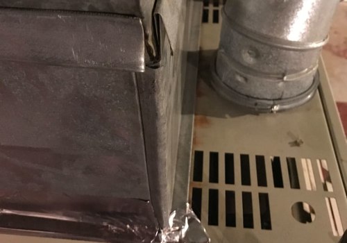
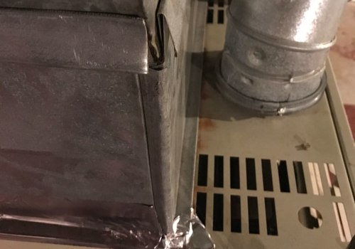
ENERGY STAR estimates that leaks, holes, and loose connections waste 20 to 30 percent of the air moving through a typical duct system. Return ducts pull air toward the blower, so a gap in a return running through the attic, crawlspace, or garage draws in air that never touched your filter.
A few steps keep it out and protect your greatest assets: your family, your home, and your HVAC system.
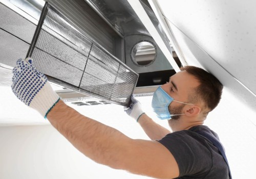
Close up and recirculate. Shut windows and doors, close any fresh-air intake, and switch the thermostat fan from "Auto" to "On" so air keeps moving through the filter.
Upgrade the filter. EPA recommends MERV 13 or higher during smoky periods, provided your system keeps normal airflow. Pair a high-efficiency filter with a continuously running fan and you can cut indoor PM2.5 by about half.
Check it often. Pull the filter every week or two during smoke events and swap it when it turns dark.
Seal the joints you can reach. Mastic or metal foil tape works on accessible duct joints. ENERGY STAR warns against cloth duct tape because it doesn't last.
Bring in a pro for hidden leaks. A duct sealing contractor can pressure-test the system and seal runs buried inside walls and ceilings.
"In my years sealing ductwork, the return side is where I keep finding outside air getting in. A loose return connection in an attic will pull hot attic air straight to the blower, and during a smoke event that air is loaded with fine particles the filter then has to catch."
7 Essential Resources
Live Oregon Wildfire and Smoke Map: fire layers, smoke coverage, and at-home steps in one view.
Oregon DEQ Fire and Air Quality Map: DEQ's statewide map with its icon legend.
AirNow Fire and Smoke Map Information: the official user guide and Q&A.
OHA Youth Outdoor Activity Guidance: the June 2026 AQI thresholds.
Central Oregon Smoke and Air Quality: regional maps and AQI health levels.
CDC: How Wildfire Smoke Affects Your Body: symptoms and who faces higher risk.
NOAA Hazard Mapping System: the satellite source behind smoke plume layers.
3 Supporting Statistics
20 to 30 percent of the air moving through a typical home duct system escapes through leaks, holes, and poor connections. ENERGY STAR
2,746 wildfires burned 324,601 acres in Oregon in 2025, out of 77,850 wildfires nationwide. National Interagency Coordination Center
55 to 60 percent is where indoor PM2.5 typically sits, relative to outdoor levels, during smoke events with the house closed up and no air cleaner running. U.S. EPA
Final Thoughts and Opinion
I'll say it plainly: the Oregon smoke map is one of the best free tools you have before a day outside, and most people use exactly one feature of it. They glance at the color over their own neighborhood and close the app. Checking your destination and trusting ground monitors over plumes will change more of your decisions than anything else.
I'd also trust the OHA thresholds over the sky. Fine particles can run high when you can barely smell smoke. And from the duct side, the day you get home from a smoky outing is a good day to check your returns. A tight duct system, air ionizers installation, and a fresh filter keep the clean air you went looking for.
Frequently Asked Questions
Why don't the numbers on the Oregon smoke map match the AQI?
They measure different things. Tap a monitor and the number you see is a PM2.5 concentration in micrograms per cubic meter, while the icon color shows the AQI category. For the AQI number itself, check DEQ's Air Quality Index page or the OregonAIR app.
Why does the map show smoke when the air looks clear?
Satellite plumes capture smoke anywhere in the atmosphere, often thousands of feet overhead, and much of it never reaches the ground. If nearby monitors read green or yellow, the air at the surface is likely fine. A wind shift can change that fast, though.
Are the sensor readings on the map accurate?
Much more than raw readings would be. EPA and the Forest Service quality-check and correct low-cost sensor data before it appears on the map. Regulatory monitors remain the reference, so when the two disagree, give the monitor more weight.
What time of day is smoke usually worst in Oregon valleys?
Often it's early morning. Overnight inversions in the Willamette, Umpqua, and Rogue Valleys can trap smoke near the ground until the air mixes later in the morning. Check again before noon before you cancel afternoon plans.
Should kids play outside when the AQI is 120?
Under OHA's June 2026 guidance, any reading from 101 to 150 means lowering activity intensity for all youth, no matter how long the activity lasts. If you can't change the intensity or the length, OHA suggests moving or canceling it.
Can leaky ducts let wildfire smoke into my house?
Yes. Return ducts pull air toward the blower, so gaps in returns that run through attics, crawlspaces, or garages can draw in unfiltered air. Sealing reachable joints and running a MERV 8 filter both help.
Check the Oregon Smoke Map Before Your Next Outing
Pull up the Oregon smoke map for your destination, read the monitor closest to where you'll be, and compare it with the OHA thresholds before you head out. When you get home, take a quick look at your filter, duct joints, and best air-purifying houseplants so the clean air you planned for outside is waiting for you inside.